County Maps
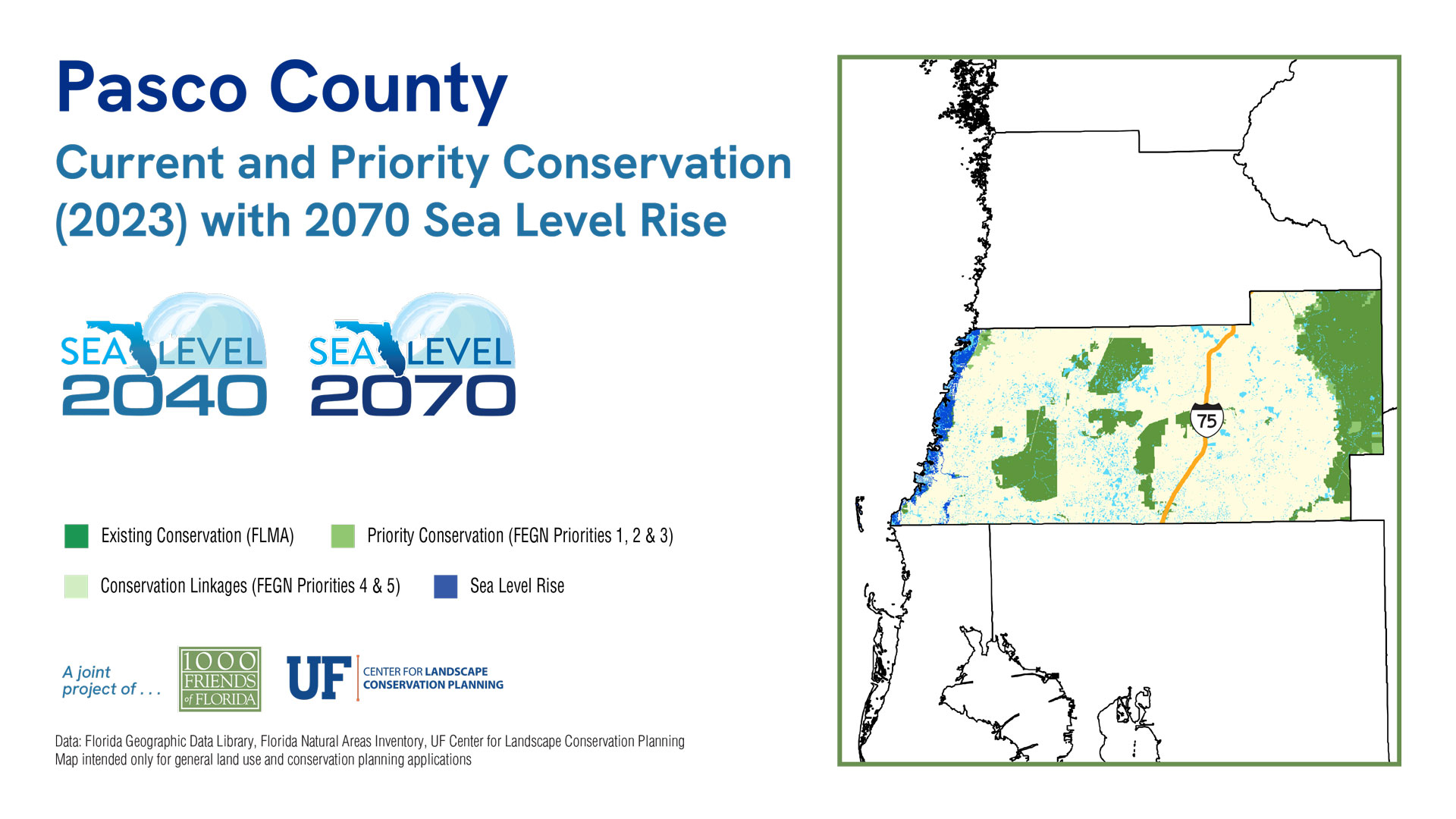
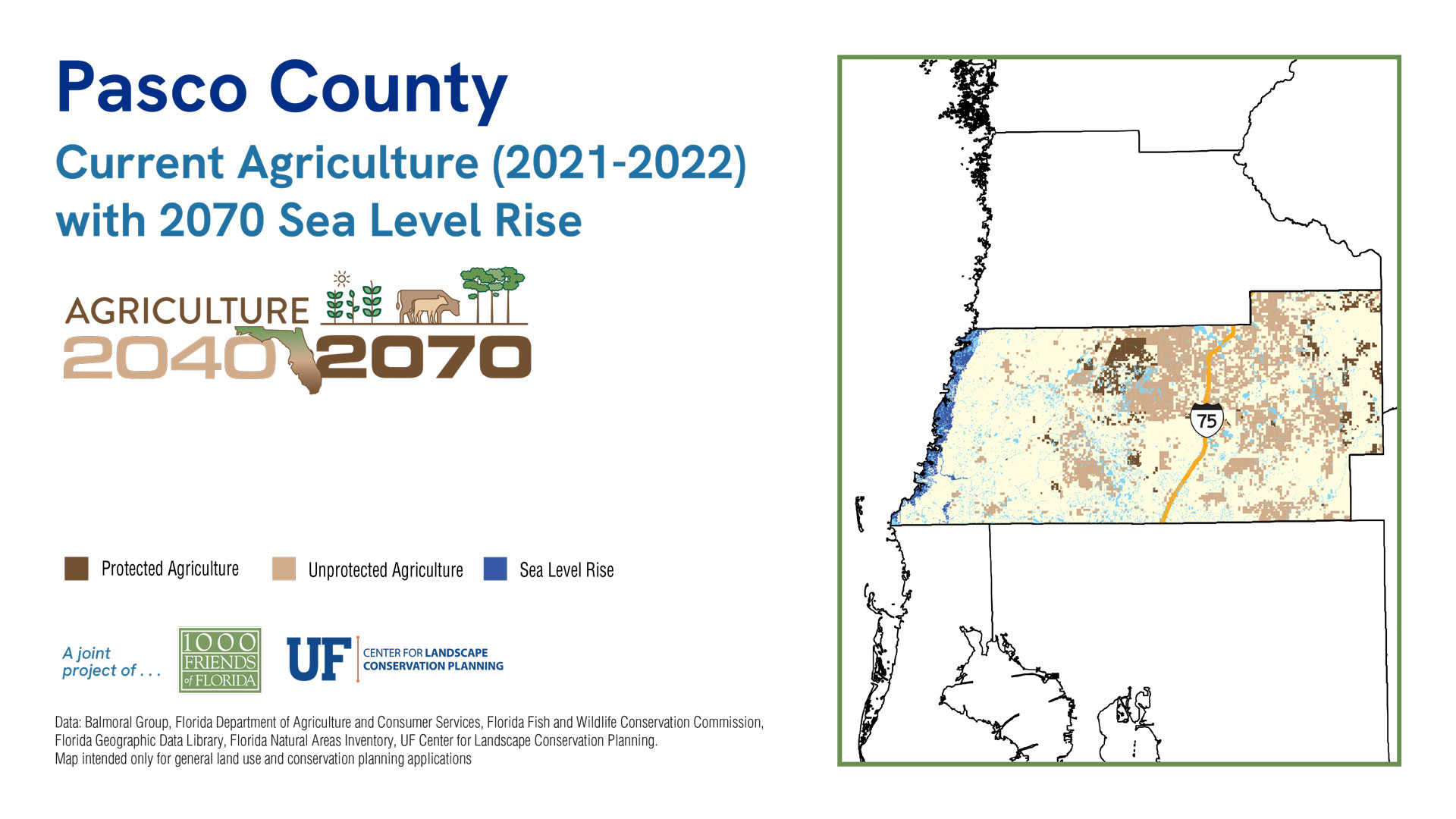
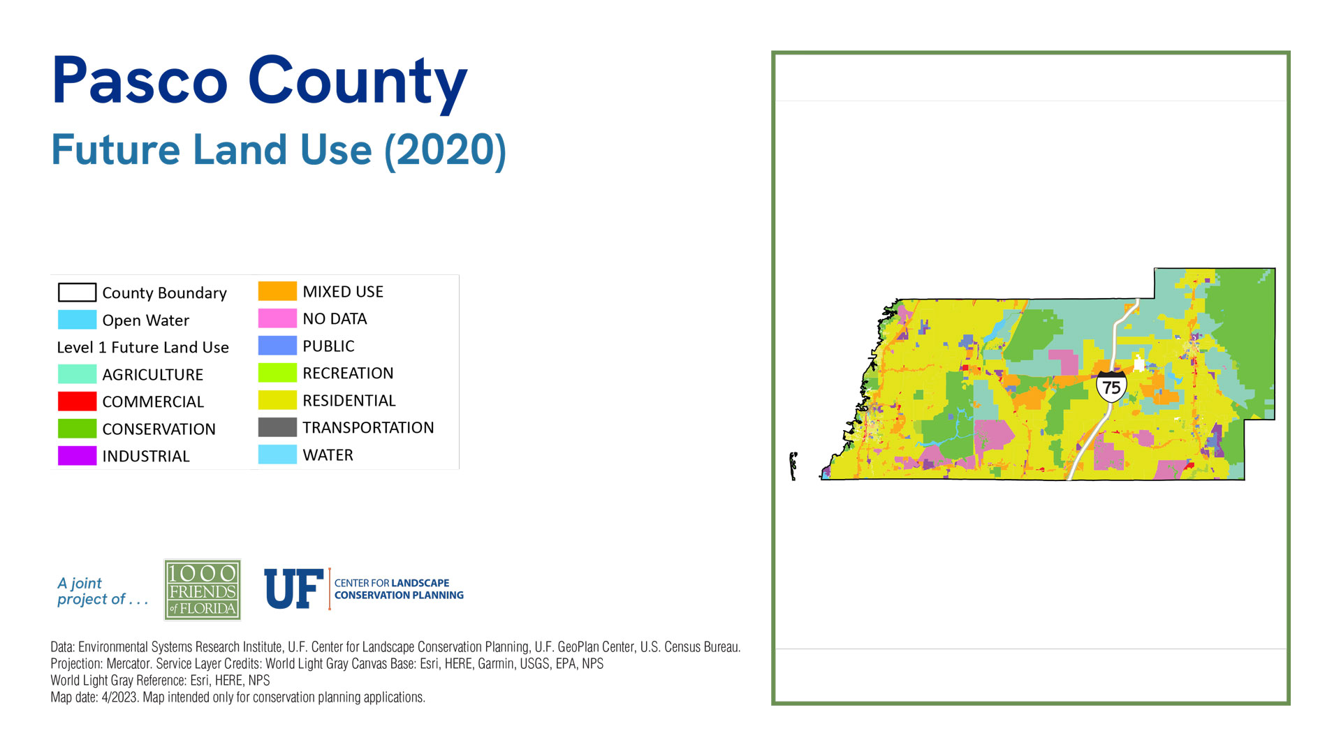
Pasco County
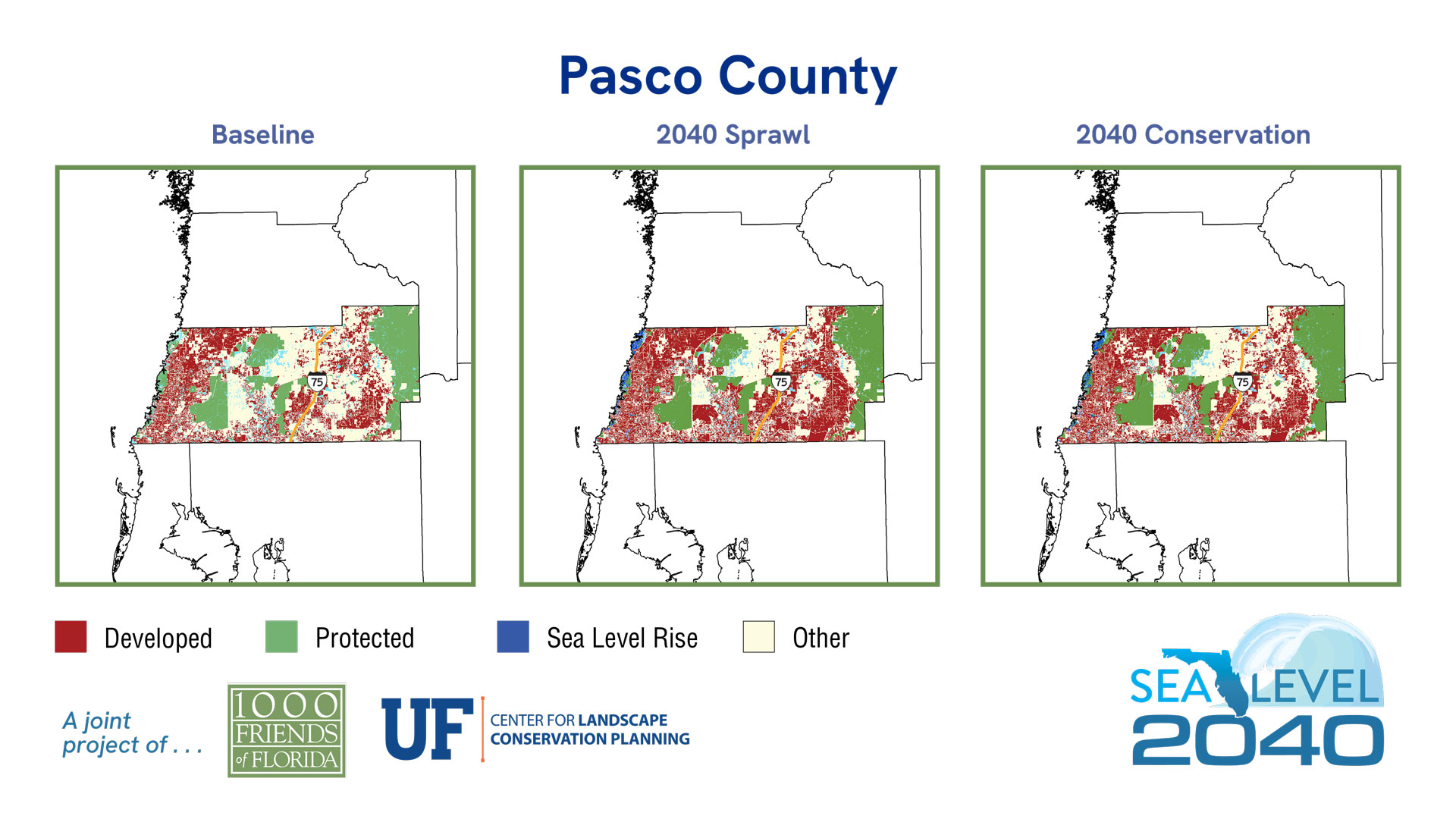
Sea Level 2040:
Baseline
2040 Sprawl
2040 Conservation
| 2019 | % of Total Acreage | Sprawl 2040 | % of Total Acreage | Conservation 2040 | % of Total Acreage | |
|---|---|---|---|---|---|---|
| Developed | 140,141 | 28.61% | 178,546 | 36.45% | 170,250 | 34.76% |
| Protected Natural Land | 98,988 | 20.21% | 96,221 | 19.64% | 99,591 | 20.33% |
| Protected Agriculture | 10,907 | 2.23% | 10,907 | 2.23% | 12,646 | 2.58% |
| Agriculture | 93,900 | 19.17% | 72,083 | 14.72% | 74,997 | 15.31% |
| Other* | 120,946 | 24.69% | 102,408 | 20.91% | 102,681 | 20.96% |
| 2019 Open Water | 24,943 | 5.09% | 24,943 | 5.09% | 24,943 | 5.09% |
| Sea Level Inundation: Protected Lands | 0 | 0.00% | 2,767 | 0.56% | 3,595 | 0.73% |
| Sea Level Inundation: All Other Land Uses | 0 | 0.00% | 1,950 | 0.40% | 1,122 | 0.23% |
| Total Acreage | 489,825 | 100.00% | 489,825 | 100.00% | 489,825 | 100.00% |
| Total Land Acreage | 464,882 | 94.91% | 460,165 | 93.94% | 460,165 | 93.94% |
| Total Open Water including SLR | 24,943 | 5.09% | 29,660 | 6.06% | 29,660 | 6.06% |
| Total Sea Level Inundation | 0 | 0.00% | 4,717 | 0.96% | 4,717 | 0.96% |
Population
Sea Level 2070:
Baseline
2070 Sprawl
2070 Conservation
| 2019 | % of Total Acreage | Sprawl 2070 | % of Total Acreage | Conservation 2070 | % of Total Acreage | |
|---|---|---|---|---|---|---|
| Developed | 140,141 | 28.61% | 278,133 | 56.78% | 210,806 | 43.04% |
| Protected Natural Land | 98,988 | 20.21% | 94,136 | 19.22% | 97,322 | 19.87% |
| Protected Agriculture | 10,907 | 2.23% | 10,907 | 2.23% | 9,785 | 2.00% |
| Agriculture | 93,900 | 19.17% | 10,112 | 2.06% | 47,735 | 9.75% |
| Other* | 120,946 | 24.69% | 63,749 | 13.01% | 91,389 | 18.66% |
| 2019 Open Water | 24,943 | 5.09% | 24,943 | 5.09% | 24,943 | 5.09% |
| Sea Level Inundation: Protected Lands | 0 | 0.00% | 4,218 | 0.86% | 5,029 | 1.03% |
| Sea Level Inundation: All Other Land Uses | 0 | 0.00% | 3,627 | 0.74% | 2,816 | 0.57% |
| Total Acreage | 489,825 | 100.00% | 489,825 | 100.00% | 489,825 | 100.00% |
| Total Land Acreage | 464,882 | 94.91% | 457,037 | 93.31% | 457,037 | 93.31% |
| Total Open Water including SLR | 24,943 | 5.09% | 32,788 | 6.69% | 32,788 | 6.69% |
| Total Sea Level Inundation | 0 | 0.00% | 7,845 | 1.60% | 7,845 | 1.60% |


