County Maps
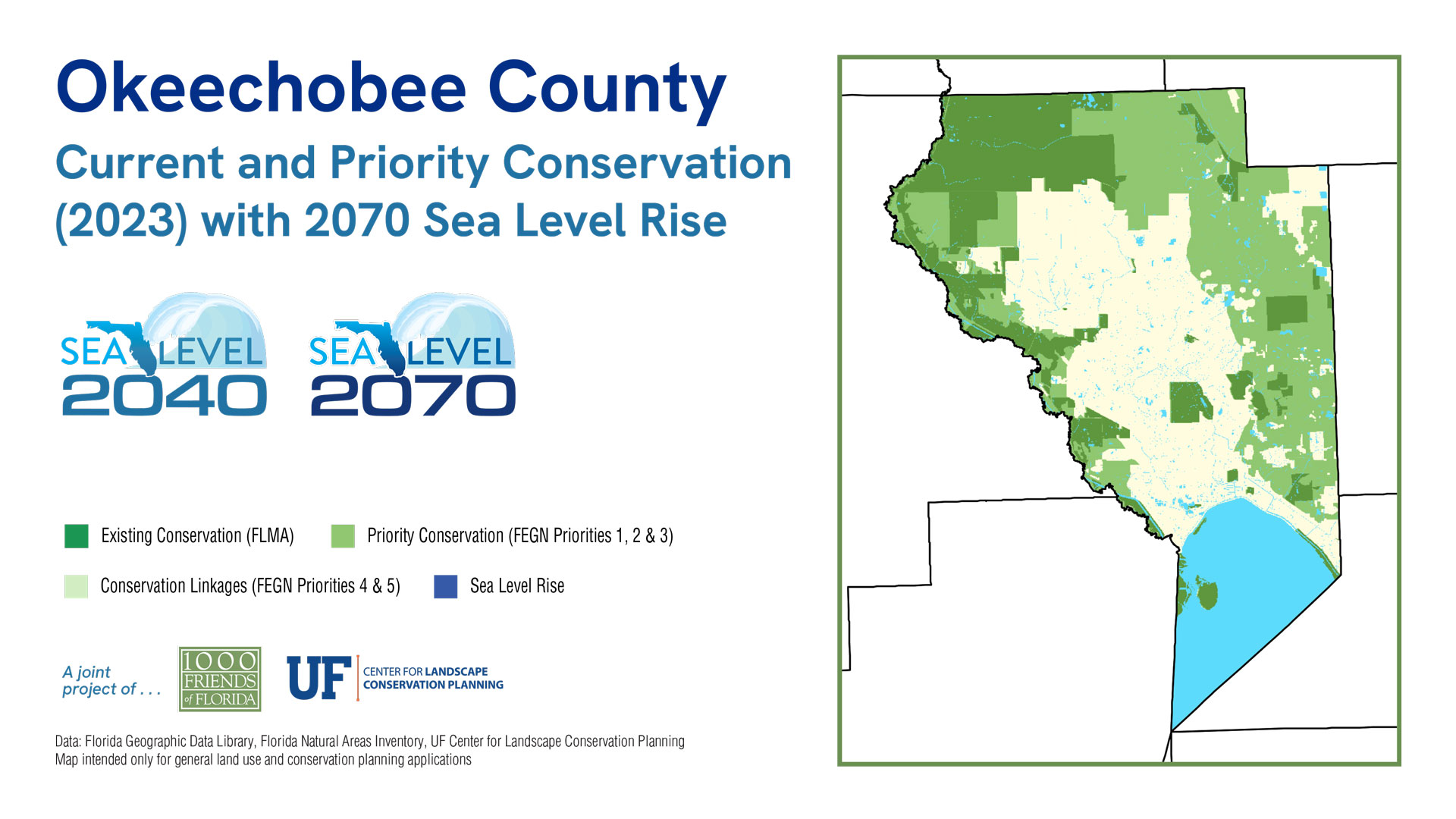
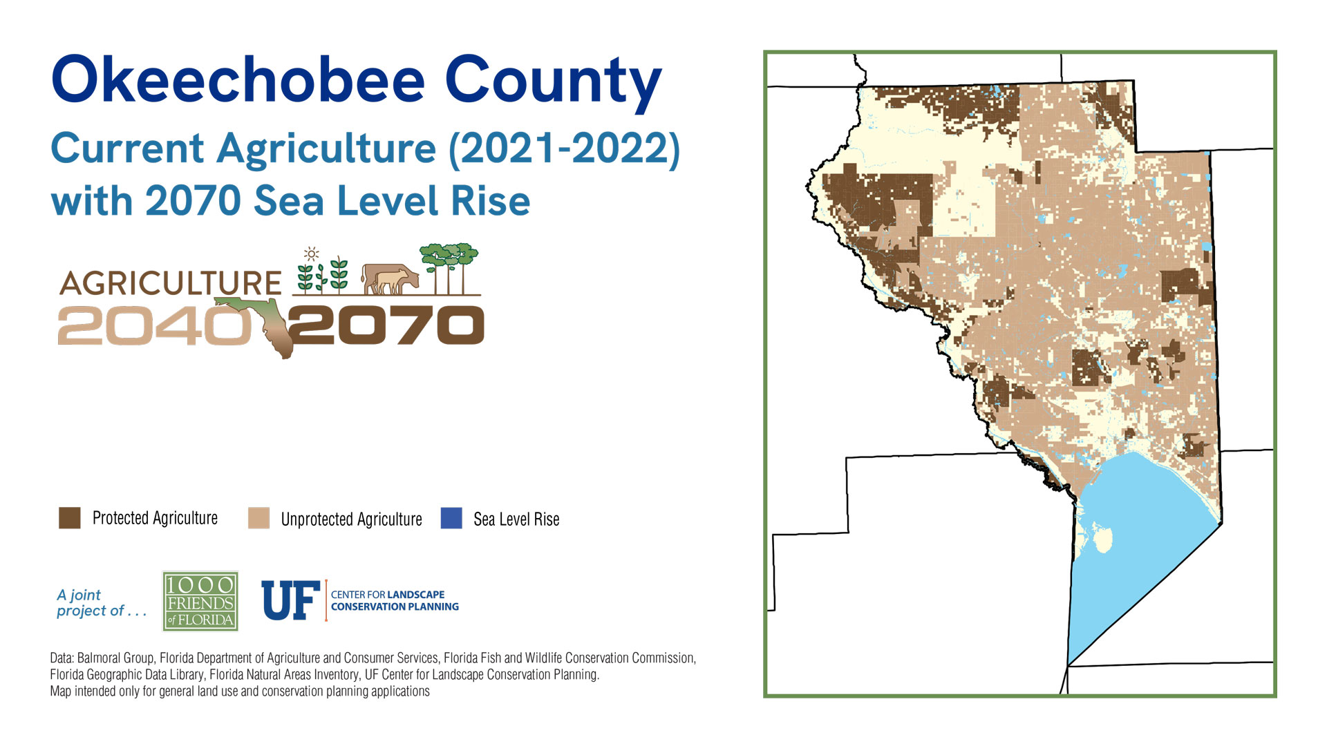
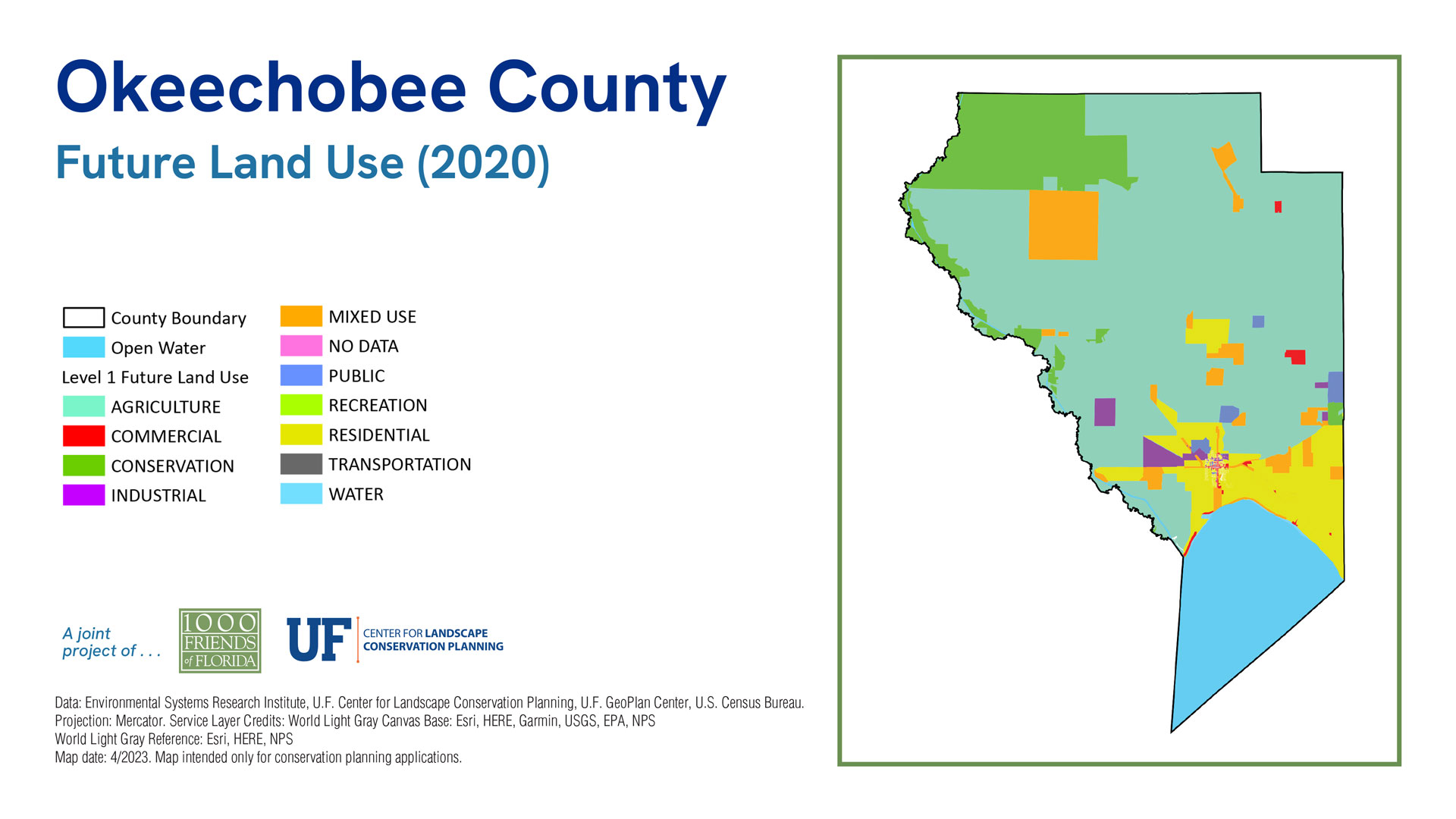
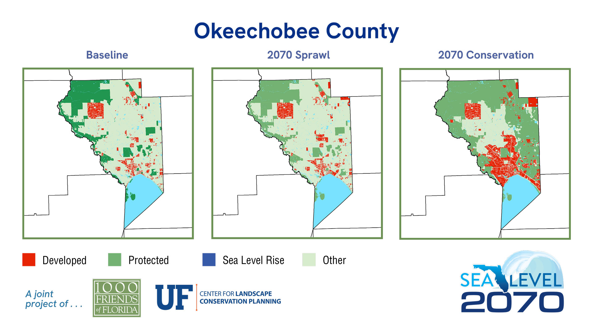
Okeechobee County
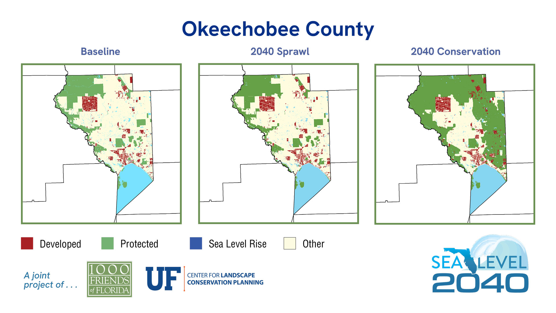
Sea Level 2040:
Baseline
2040 Sprawl
2040 Conservation
| 2019 | % of Total Acreage | Sprawl 2040 | % of Total Acreage | Conservation 2040 | % of Total Acreage | |
|---|---|---|---|---|---|---|
| Developed | 36,374 | 6.37% | 36,755 | 6.44% | 36,755 | 6.44% |
| Protected Natural Land | 58,601 | 10.27% | 58,601 | 10.27% | 83,491 | 14.63% |
| Protected Agriculture | 57,022 | 9.99% | 57,022 | 9.99% | 198,101 | 34.70% |
| Agriculture | 282,499 | 49.49% | 282,499 | 49.49% | 141,420 | 24.78% |
| Other* | 57,298 | 10.04% | 56,917 | 9.97% | 32,027 | 5.61% |
| 2019 Open Water | 79,021 | 13.84% | 79,021 | 13.84% | 79,021 | 13.84% |
| Sea Level Inundation: Protected Lands | 0 | 0.00% | 0 | 0.00% | 0 | 0.00% |
| Sea Level Inundation: All Other Land Uses | 0 | 0.00% | 0 | 0.00% | 0 | 0.00% |
| Total Acreage | 570,815 | 100.00% | 570,815 | 100.00% | 570,815 | 100.00% |
| Total Land Acreage | 491,794 | 86.16% | 491,794 | 86.16% | 491,794 | 86.16% |
| Total Open Water including SLR | 79,021 | 13.84% | 79,021 | 13.84% | 79,021 | 13.84% |
Population
Sea Level 2070:
Baseline
2070 Sprawl
2070 Conservation
| 2019 | % of Total Acreage | Sprawl 2070 | % of Total Acreage | Conservation 2070 | % of Total Acreage | |
|---|---|---|---|---|---|---|
| Developed | 36,374 | 6.37% | 41,458 | 7.26% | 86,963 | 15.23% |
| Protected Natural Land | 58,601 | 10.27% | 58,601 | 10.27% | 83,491 | 14.63% |
| Protected Agriculture | 57,022 | 9.99% | 57,022 | 9.99% | 185,856 | 32.56% |
| Agriculture | 282,499 | 49.49% | 278,320 | 48.76% | 98,720 | 17.29% |
| Other* | 57,298 | 10.04% | 56,393 | 9.88% | 36,764 | 6.44% |
| 2019 Open Water | 79,021 | 13.84% | 79,021 | 13.84% | 79,021 | 13.84% |
| Sea Level Inundation: Protected Lands | 0 | 0.00% | 0 | 0.00% | 0 | 0.00% |
| Sea Level Inundation: All Other Land Uses | 0 | 0.00% | 0 | 0.00% | 0 | 0.00% |
| Total Acreage | 570,815 | 100.00% | 570,815 | 100.00% | 570,815 | 100.00% |
| Total Land Acreage | 491,794 | 86.16% | 491,794 | 86.16% | 491,794 | 86.16% |
| Total Open Water including SLR | 79,021 | 13.84% | 79,021 | 13.84% | 79,021 | 13.84% |
