County Maps
Lafayette County
Sea Level 2040:
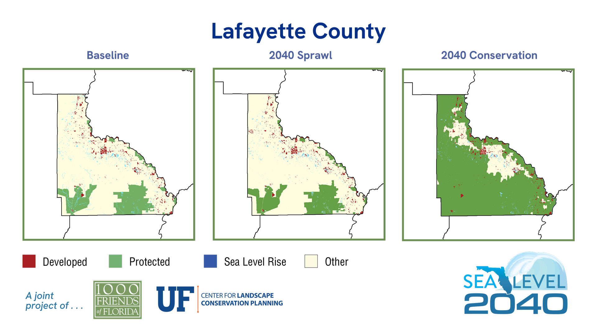
Baseline
2040 Sprawl
2040 Conservation
| 2019 | % of Total Acreage | Sprawl 2040 | % of Total Acreage | Conservation 2040 | % of Total Acreage | |
|---|---|---|---|---|---|---|
| Developed | 8,446 | 2.41% | 8,713 | 2.48% | 8,637 | 2.46% |
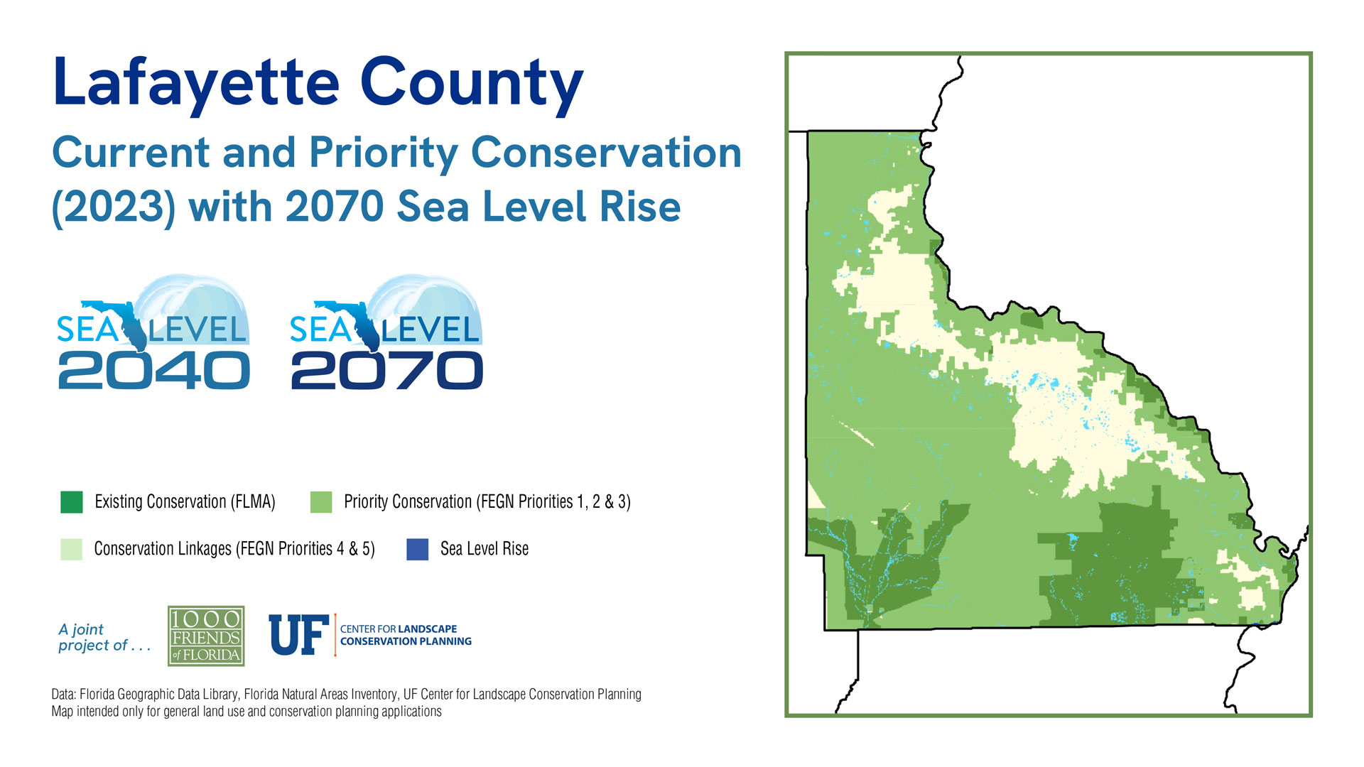
| Protected Natural Land | 58,658 | 16.73% | 58,658 | 16.73% | 262,066 | 74.74% |
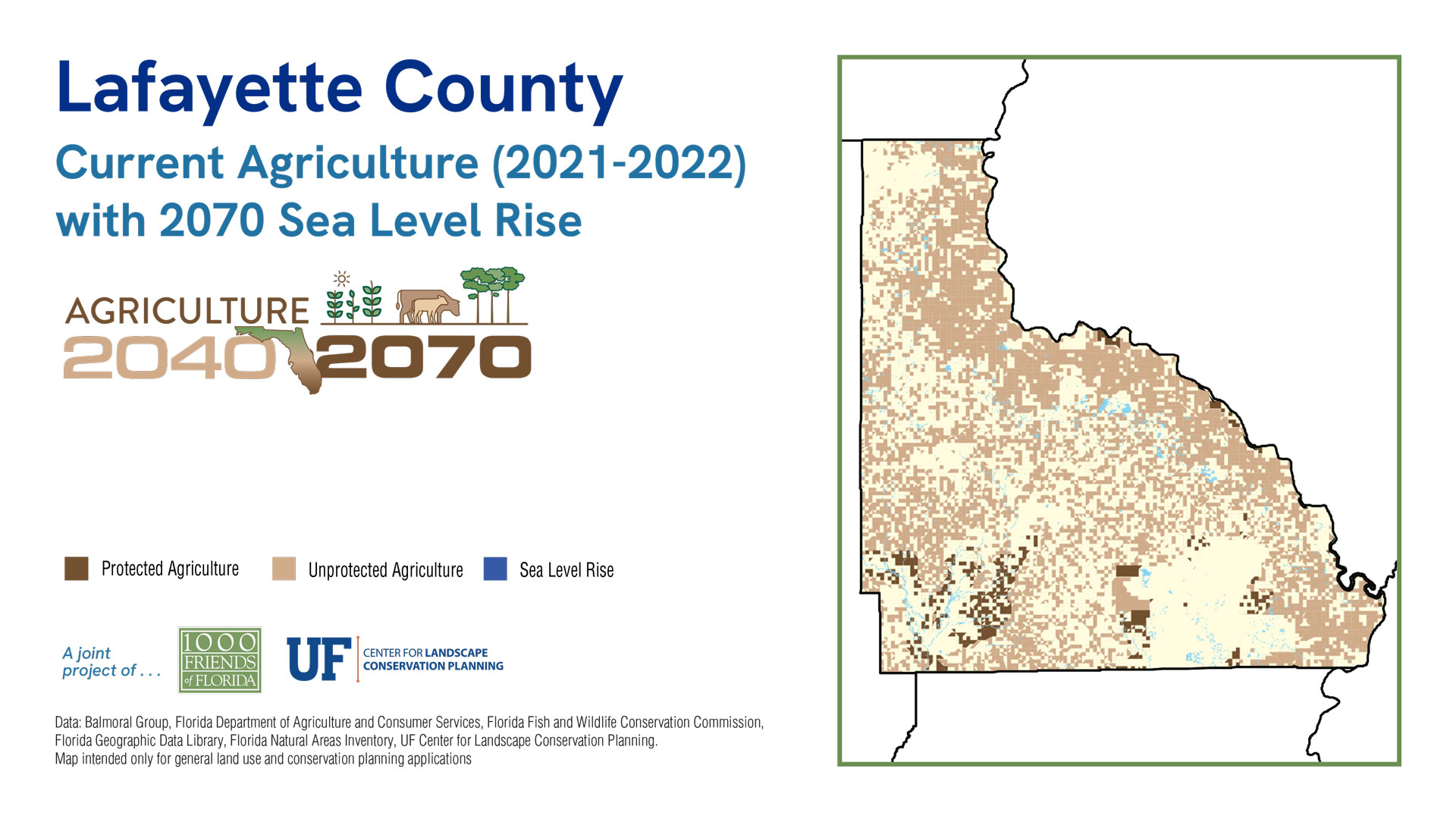
| Protected Agriculture | 845 | 0.24% | 845 | 0.24% | 13,511 | 3.85% |
| Agriculture | 41,576 | 11.86% | 41,576 | 11.86% | 28,870 | 8.23% |
| Other* | 236,478 | 67.44% | 236,211 | 67.36% | 32,919 | 9.39% |
| 2019 Open Water | 4,657 | 1.33% | 4,657 | 1.33% | 4,657 | 1.33% |
| Sea Level Inundation: Protected Lands | 0 | 0.00% | 0 | 0.00% | 0 | 0.00% |
| Sea Level Inundation: All Other Land Uses | 0 | 0.00% | 0 | 0.00% | 0 | 0.00% |
| Total Acreage | 350,660 | 100.00% | 350,660 | 100.00% | 350,660 | 100.00% |
| Total Land Acreage | 346,003 | 98.67% | 346,003 | 98.67% | 346,003 | 98.67% |
| Total Open Water including SLR | 4,657 | 1.33% | 4,657 | 1.33% | 4,657 | 1.33% |
Population
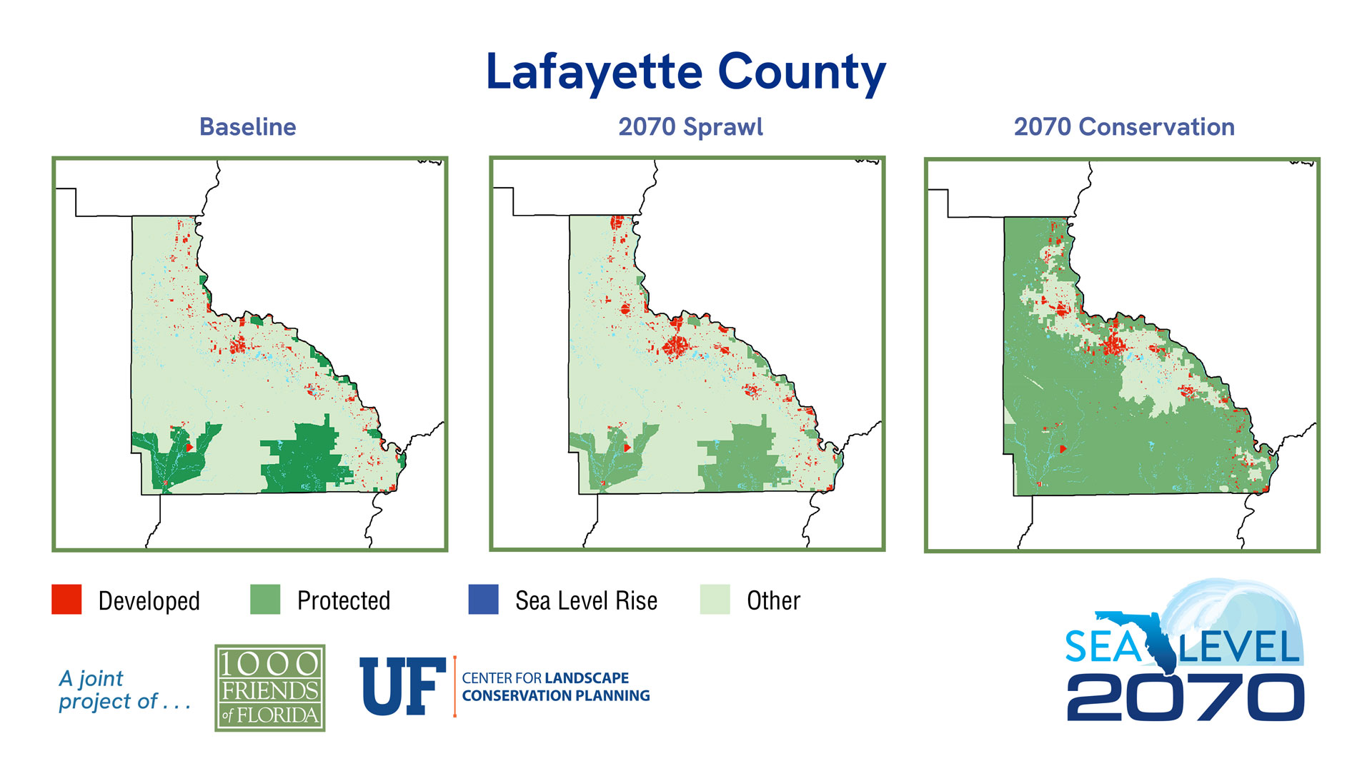
Sea Level 2070:
Baseline
2070 Sprawl
2070 Conservation
| 2019 | % of Total Acreage | Sprawl 2070 | % of Total Acreage | Conservation 2070 | % of Total Acreage | |
|---|---|---|---|---|---|---|
| Developed | 8,446 | 2.41% | 12,236 | 3.49% | 11,333 | 3.23% |
| Protected Natural Land | 58,658 | 16.73% | 58,658 | 16.73% | 262,066 | 74.74% |
| Protected Agriculture | 845 | 0.24% | 845 | 0.24% | 13,510 | 3.85% |
| Agriculture | 41,576 | 11.86% | 40,577 | 11.57% | 27,513 | 7.85% |
| Other* | 236,478 | 67.44% | 233,687 | 66.64% | 31,581 | 9.01% |
| 2019 Open Water | 4,657 | 1.33% | 4,657 | 1.33% | 4,657 | 1.33% |
| Sea Level Inundation: Protected Lands | 0 | 0.00% | 0 | 0.00% | 0 | 0.00% |
| Sea Level Inundation: All Other Land Uses | 0 | 0.00% | 0 | 0.00% | 0 | 0.00% |
| Total Acreage | 350,660 | 100.00% | 350,660 | 100.00% | 350,660 | 100.00% |
| Total Land Acreage | 346,003 | 98.67% | 346,003 | 98.67% | 346,003 | 98.67% |
| Total Open Water including SLR | 4,657 | 1.33% | 4,657 | 1.33% | 4,657 | 1.33% |
