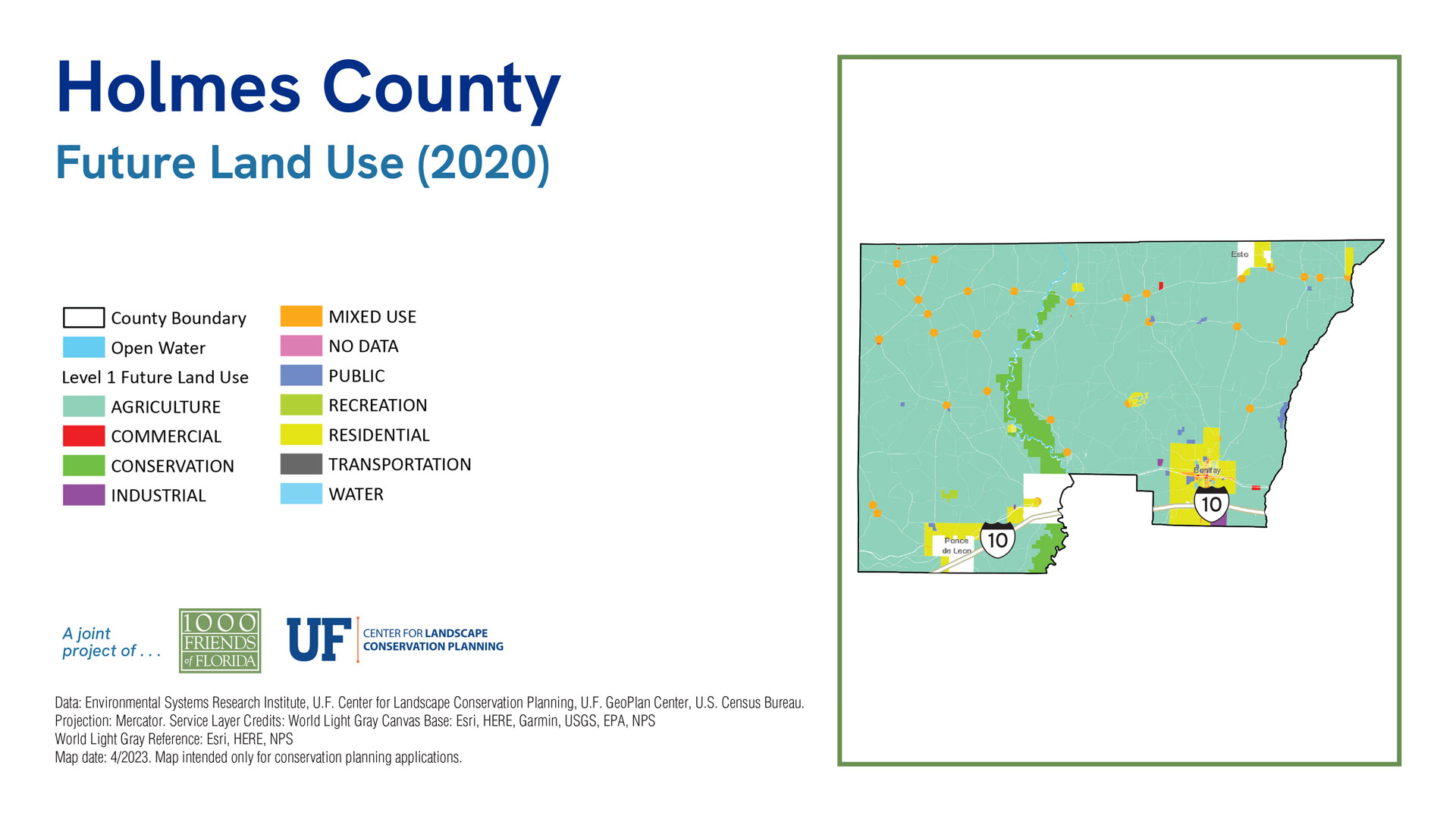
County Maps
Holmes County
Sea Level 2040:
Baseline
2040 Sprawl
2040 Conservation
| 2019 | % of Total Acreage | Sprawl 2040 | % of Total Acreage | Conservation 2040 | % of Total Acreage | |
|---|---|---|---|---|---|---|
| Developed | 22,571 | 7.21% | 23,200 | 7.41% | 23,110 | 7.38% |
| Protected Natural Land | 12,991 | 4.15% | 12,991 | 4.15% | 62,413 | 19.94% |
| Protected Agriculture | 3 | 0.00% | 3 | 0.00% | 7,710 | 2.46% |
| Agriculture | 69,109 | 22.08% | 69,007 | 22.05% | 61,336 | 19.60% |
| Other* | 202,135 | 64.58% | 201,608 | 64.42% | 152,240 | 48.64% |
| 2019 Open Water | 6,167 | 1.97% | 6,167 | 1.97% | 6,167 | 1.97% |
| Sea Level Inundation: Protected Lands | 0 | 0.00% | 0 | 0.00% | 0 | 0.00% |
| Sea Level Inundation: All Other Land Uses | 0 | 0.00% | 0 | 0.00% | 0 | 0.00% |
| Total Acreage | 312,976 | 100.00% | 312,976 | 100.00% | 312,976 | 100.00% |
| Total Land Acreage | 306,809 | 98.03% | 306,809 | 98.03% | 306,809 | 98.03% |
| Total Open Water including SLR | 6,167 | 1.97% | 6,167 | 1.97% | 6,167 | 1.97% |
Population
Sea Level 2070:
Baseline
2070 Sprawl
2070 Conservation
| 2019 | % of Total Acreage | Sprawl 2070 | % of Total Acreage | Conservation 2070 | % of Total Acreage | |
|---|---|---|---|---|---|---|
| Developed | 22,571 | 7.21% | 26,639 | 8.51% | 25,817 | 8.25% |
| Protected Natural Land | 12,991 | 4.15% | 12,991 | 4.15% | 62,413 | 19.94% |
| Protected Agriculture | 3 | 0.00% | 3 | 0.00% | 7,710 | 2.46% |
| Agriculture | 69,109 | 22.08% | 67,491 | 21.56% | 60,215 | 19.24% |
| Other* | 202,135 | 64.58% | 199,685 | 63.80% | 150,654 | 48.14% |
| 2019 Open Water | 6,167 | 1.97% | 6,167 | 1.97% | 6,167 | 1.97% |
| Sea Level Inundation: Protected Lands | 0 | 0.00% | 0 | 0.00% | 0 | 0.00% |
| Sea Level Inundation: All Other Land Uses | 0 | 0.00% | 0 | 0.00% | 0 | 0.00% |
| Total Acreage | 312,976 | 100.00% | 312,976 | 100.00% | 312,976 | 100.00% |
| Total Land Acreage | 306,809 | 98.03% | 306,809 | 98.03% | 306,809 | 98.03% |
| Total Open Water including SLR | 6,167 | 1.97% | 6,167 | 1.97% | 6,167 | 1.97% |


