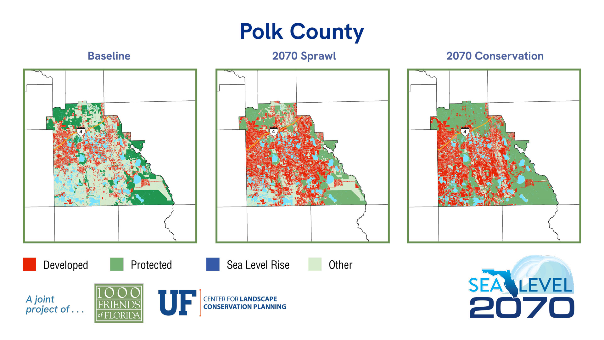
County Maps
Polk County
Sea Level 2040:
Baseline
2040 Sprawl
2040 Conservation
| 2019 | % of Total Acreage | Sprawl 2040 | % of Total Acreage | Conservation 2040 | % of Total Acreage | |
|---|---|---|---|---|---|---|
| Developed | 215,829 | 16.77% | 272,953 | 21.21% | 260,978 | 20.28% |
| Protected Natural Land | 212,920 | 16.55% | 212,920 | 16.55% | 366,690 | 28.50% |
| Protected Agriculture | 80,356 | 6.25% | 80,356 | 6.25% | 183,108 | 14.23% |
| Agriculture | 260,528 | 20.25% | 228,185 | 17.73% | 130,945 | 10.18% |
| Other* | 368,213 | 28.62% | 343,432 | 26.69% | 196,125 | 15.24% |
| 2019 Open Water | 148,834 | 11.57% | 148,834 | 11.57% | 148,834 | 11.57% |
| Sea Level Inundation: Protected Lands | 0 | 0.00% | 0 | 0.00% | 0 | 0.00% |
| Sea Level Inundation: All Other Land Uses | 0 | 0.00% | 0 | 0.00% | 0 | 0.00% |
| Total Acreage | 1,286,680 | 100.00% | 1,286,680 | 100.00% | 1,286,680 | 100.00% |
| Total Land Acreage | 1,137,846 | 88.43% | 1,137,846 | 88.43% | 1,137,846 | 88.43% |
| Total Open Water including SLR | 148,834 | 11.57% | 148,834 | 11.57% | 148,834 | 11.57% |
Population
Sea Level 2070:
Baseline
2070 Sprawl
2070 Conservation
| 2019 | % of Total Acreage | Sprawl 2070 | % of Total Acreage | Conservation 2070 | % of Total Acreage | |
|---|---|---|---|---|---|---|
| Developed | 215,829 | 16.77% | 493,306 | 38.34% | 452,528 | 35.17% |
| Protected Natural Land | 212,920 | 16.55% | 212,920 | 16.55% | 366,690 | 28.50% |
| Protected Agriculture | 80,356 | 6.25% | 80,356 | 6.25% | 178,324 | 13.86% |
| Agriculture | 260,528 | 20.25% | 113,551 | 8.83% | 59,739 | 4.64% |
| Other* | 368,213 | 28.62% | 237,713 | 18.47% | 80,565 | 6.26% |
| 2019 Open Water | 148,834 | 11.57% | 148,834 | 11.57% | 148,834 | 11.57% |
| Sea Level Inundation: Protected Lands | 0 | 0.00% | 0 | 0.00% | 0 | 0.00% |
| Sea Level Inundation: All Other Land Uses | 0 | 0.00% | 0 | 0.00% | 0 | 0.00% |
| Total Acreage | 1,286,680 | 100.00% | 1,286,680 | 100.00% | 1,286,680 | 100.00% |
| Total Land Acreage | 1,137,846 | 88.43% | 1,137,846 | 88.43% | 1,137,846 | 88.43% |
| Total Open Water including SLR | 148,834 | 11.57% | 148,834 | 11.57% | 148,834 | 11.57% |


