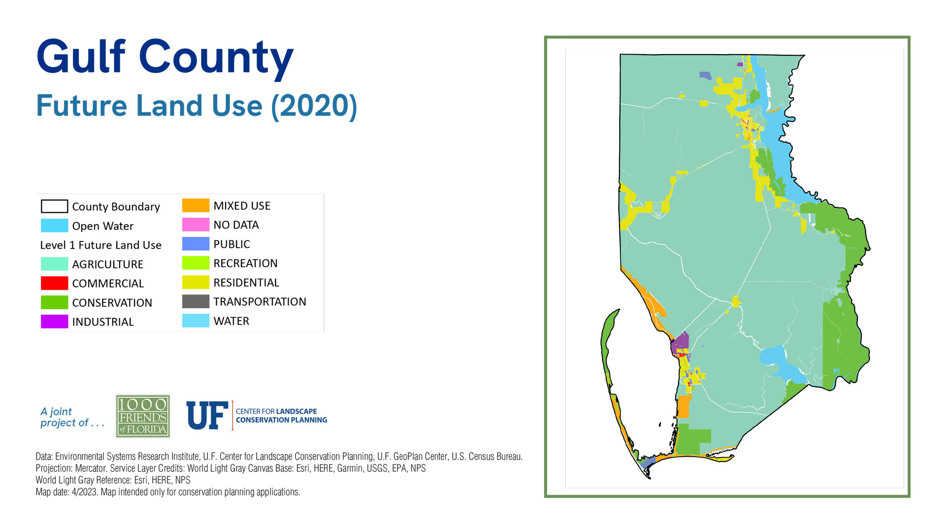
County Maps
Gulf County
Sea Level 2040:
Baseline
2040 Sprawl
2040 Conservation
| 2019 | % of Total Acreage | Sprawl 2040 | % of Total Acreage | Conservation 2040 | % of Total Acreage | |
|---|---|---|---|---|---|---|
| Developed | 16,094 | 4.42% | 19,235 | 5.28% | 17,276 | 4.74% |
| Protected Natural Land | 68,777 | 18.89% | 58,778 | 16.14% | 312,693 | 85.86% |
| Protected Agriculture | 293 | 0.08% | 293 | 0.08% | 6,997 | 1.92% |
| Agriculture | 7,052 | 1.94% | 7,042 | 1.93% | 107 | 0.03% |
| Other* | 262,475 | 72.07% | 254,740 | 69.95% | 3,016 | 0.83% |
| 2019 Open Water | 9,486 | 2.60% | 9,486 | 2.60% | 9,486 | 2.60% |
| Sea Level Inundation: Protected Lands | 0 | 0.00% | 9,999 | 2.75% | 14,415 | 3.96% |
| Sea Level Inundation: All Other Land Uses | 0 | 0.00% | 4,604 | 1.26% | 187 | 0.05% |
| Total Acreage | 364,177 | 100.00% | 364,177 | 100.00% | 364,177 | 100.00% |
| Total Land Acreage | 354,691 | 97.40% | 340,088 | 93.39% | 340,089 | 93.39% |
| Total Open Water including SLR | 9,486 | 2.60% | 24,089 | 6.61% | 24,088 | 6.61% |
| Total Sea Level Inundation | 0 | 0.00% | 14,603 | 4.01% | 14,602 | 4.01% |
Population
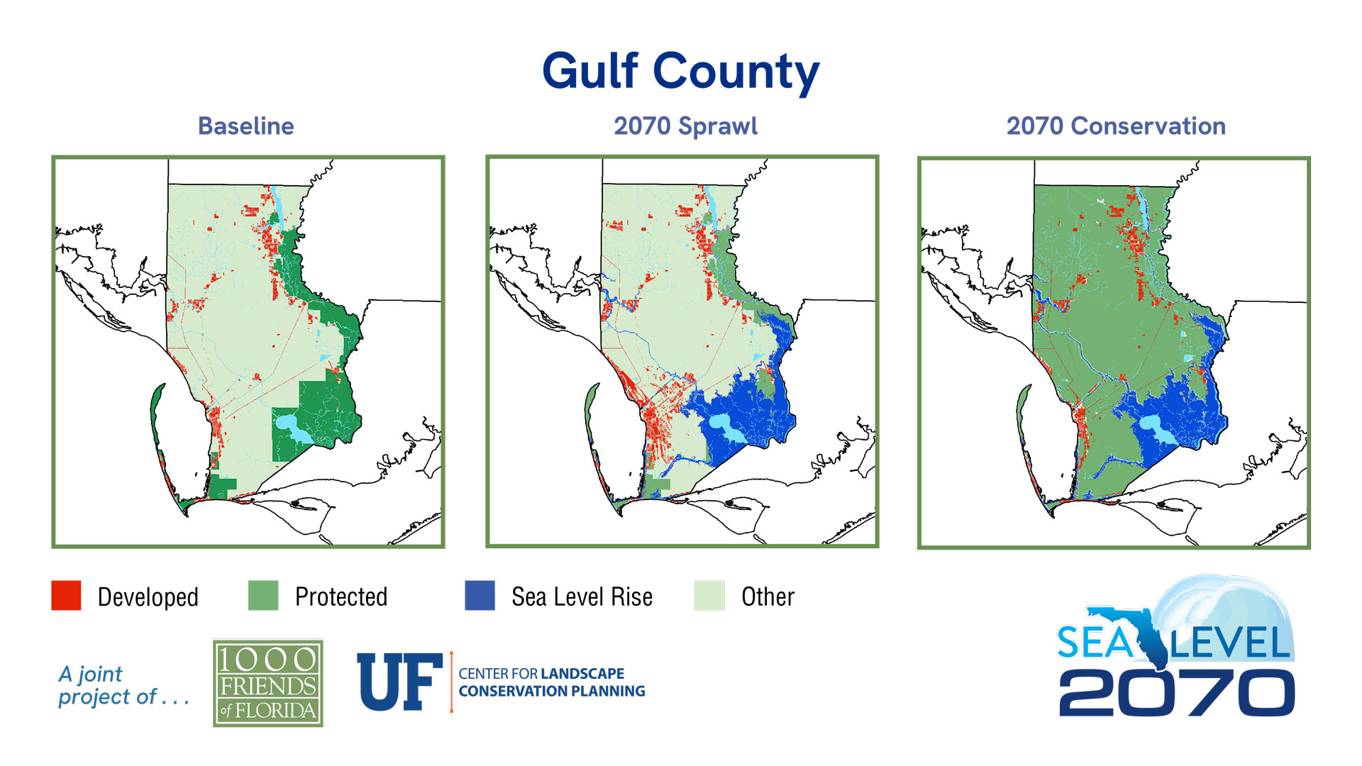
Sea Level 2070:
Baseline
2070 Sprawl
2070 Conservation
| 2019 | % of Total Acreage | Sprawl 2070 | % of Total Acreage | Conservation 2070 | % of Total Acreage | |
|---|---|---|---|---|---|---|
| Developed | 16,094 | 4.42% | 23,478 | 6.45% | 16,079 | 4.42% |
| Protected Natural Land | 68,777 | 18.89% | 28,199 | 7.74% | 272,447 | 74.81% |
| Protected Agriculture | 293 | 0.08% | 286 | 0.08% | 6,989 | 1.92% |
| Agriculture | 7,052 | 1.94% | 6,820 | 1.87% | 109 | 0.03% |
| Other* | 262,475 | 72.07% | 244,013 | 67.00% | 7,172 | 1.97% |
| 2019 Open Water | 9,486 | 2.60% | 9,486 | 2.60% | 9,486 | 2.60% |
| Sea Level Inundation: Protected Lands | 0 | 0.00% | 38,659 | 10.62% | 51,129 | 14.04% |
| Sea Level Inundation: All Other Land Uses | 0 | 0.00% | 13,236 | 3.63% | 766 | 0.21% |
| Total Acreage | 364,177 | 100.00% | 364,177 | 100.00% | 364,177 | 100.00% |
| Total Land Acreage | 354,691 | 97.40% | 302,796 | 83.15% | 302,796 | 83.15% |
| Total Open Water including SLR | 9,486 | 2.60% | 61,381 | 16.85% | 61,381 | 16.85% |
| Total Sea Level Inundation | 0 | 0.00% | 51,895 | 14.25% | 51,895 | 14.25% |


